Endangered Wildlife Survey: Hawksbill Sea Turtle
Summary Intro:
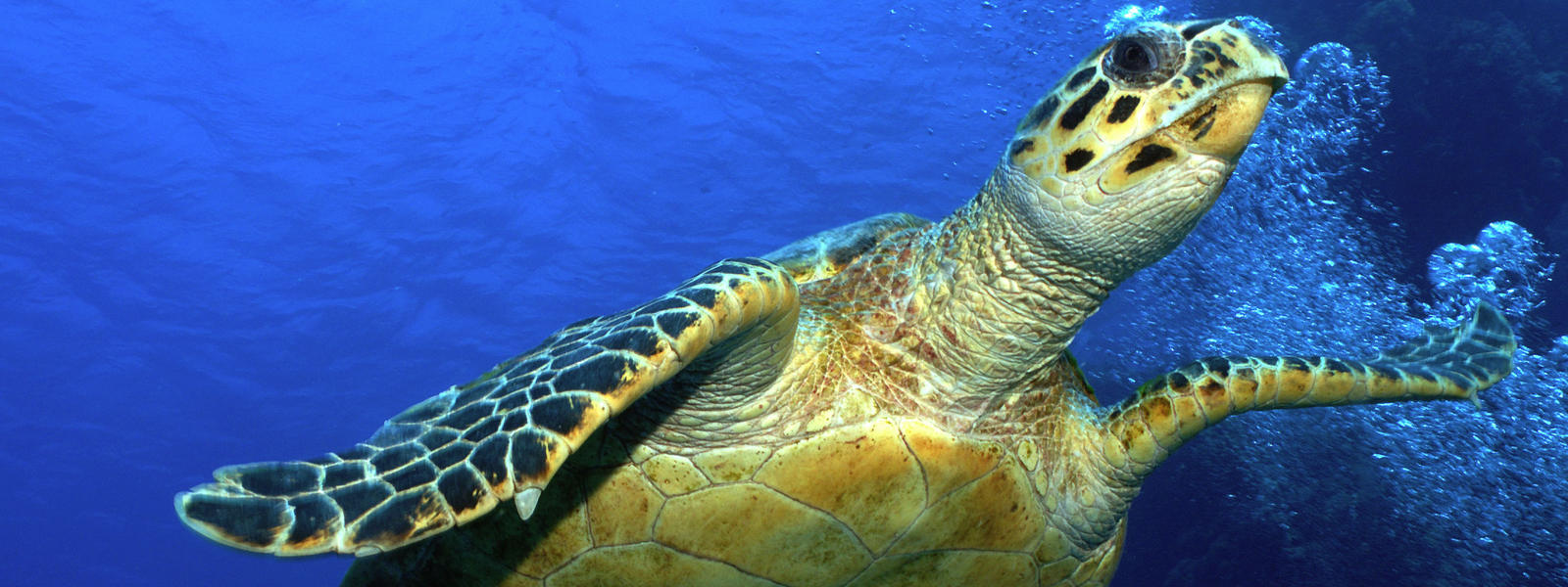
This consulting report seeks to provide unmanned aerial system platform recommendations so that conservationists can perform an inventory of Hawksbill Sea Turtles in the Hawaiian islands. More particularly, reproducing members of the Hawaiian Hawksbill population.
There are several major considerations for choosing aircraft and sensor options to accomplish this task. First of all, the Hawksbill Sea Turtle is a critically endangered species worldwide, and the hawaiian population is one of the most endangered turtle populations on Earth. Thus, to study the species, researchers must follow the endangered species act of 1973 and all of the associated regulations. Effectively, drone activity can not in any way alter the actions of the endangered animals. In other words, the turtles can not react to the unmanned aircraft in any capacity to remain compliant with the endangered species act. The easiest way to achieve this is to insure the turtles do not notice the aircraft, making sound a major consideration. Where the sea turtles are surveyed will impact any sound considerations.
Over the ocean, sound is less of a factor as it is unlikely submerged animals will notice an aircraft overhead. However, even though the hawksbill sea turtle is a notoriously shallow swimming animal, it would be much more difficult to count the turtle while it is at sea. This is because it is decently camouflaged with the water and thermal cameras are not very effective if the animal is at any significant depth due to low amounts of reflectance by water in the infrared section of the electromagnetic spectrum. Also, the target species does not travel far from where it reproduces to where it lives most of its life compared to other sea turtle species. Meaning that, if individuals were inventoried at sea, it is possible that non-reproducing individuals would be counted which is not the goal of the study. Flights at sea also require boat launches or limited duration surveys if flown from shore out towards water. For these considerations, aircraft are being
selected that could best perform beach surveys of turtle populations. This is because only reproducing individuals come to shore, removing bias of non-target individuals. This will also make finding the aircraft easier as there is greater contrast between turtle coloration and the color of the beach.
Lastly, reproductive trends are important to consider. Most notably, the fact that the turtle usually breads nocturnally. It is worth surveying during the day for nests, but if only individual organisms are going to be considered, night time drone flights are needed. This means that the sensor needs to be capable of searching for turtles in the dark, and the aircraft needs features enabling navigation and orientation at night.
Image by World Wildlife Fund
Low-Cost Drone Options
Low Cost Multi: DJI Mavic Pro Platinum w/ 8331 series propellers (68db) and a ready-to-use thermal. Approximately $4,299
For the low-level commercial quadcopter option, an appropriate platform would be the DJI Mavic Pro Platinum equipped with 8331 series propellers and a FLIR Boson 320 video camera. This platform is affordable, while also being capable of getting the task done. This is a custom build, but it can be purchased from Dronenerds.com with the thermal sensor installed. The props would need to be purchased separately and can be purchased from DJI.com. The prop customization would keep the noise level of the UAV at 68db which is much quieter than the props it comes with.
The 4k camera and thermal camera are dual mounted and can film simultaneously. The gimbal cameras are permanently mounted. The range is 4.3 miles and has a top speed of 40mph. While the maximum flight time is listed at 27, the actual time will be much lower due to the higher cross winds found along coastlines.
Some of the biggest advantages of the drone are the price point and the ability to hover. The ability to hover allows the UAV to track a specific turtle or monitor an isolated activity. A con to this platform is not made to fly in rain or snow (no weather resistance). Also, the flight time would be considerably lower than maximum on windy days. This is an important consideration since weather near the coastline is often not stable.
Image provided by FLIR
Low Cost Fixed wing: Skywalker x8 with pixhawk 2 and sony a6000. Aircraft all inclusive: $220, Pixhawk 2 and GPS: $330, Sony a7R: $909, folding props for more silent flying Aeronauts 12 x 8, $13.00 (about $1475).
As a low cost fixed wing option, a modified RC aircraft is likely the most cost effective option. While at first this option may seem non-ideal or even unprofessional versus proprietary options, a custom built aircraft can be very effective or even more effective when compared to proprietary choices. A strong recommendation is the Skywalker x8 fixed wing aircraft frame will all inclusive systems. The only hardware that would need to be purchased separate is an autopilot and GPS system, which we recommend the Pixhawk 2 open source autopilot platform and branded GPS Unit. This system is highly customizable and programmable for a variety of mission types, as well as highly supported with many users combining the system with the skywalker x8 platform. To take into consideration sound, foldable props are recommended as they are quieter than non-foldable propellers and can even be entirely silent at the time of image capture by programming in a temporary glide feature. Foldable propellers will fold in flight when low to zero thrust is applied and be entirely silent. We recommend Aeronauts 12 x 8 foldable propellers as a highly rated and fair priced choice.
For sensor considerations, we recommend the Sony a7R RGB mirrorless camera. As a negative, this sensor will work best during daylight situations, limiting use during prime turtle nesting time. However, nested sites can be delineated without the presence of adult turtles and from that information, total turtle count can be interpolated. The camera has a large sensor and very fast shutter speed making it ideal for mapping operations of coastline. The sensor is 24 megapixel from which, a very high spatial resolution can be achieved to find small features associated with turtle nests.
As far as aircraft performance, this aircraft is hand launched, or catapult launched, and can land in a deep stall condition or an installed parachute system. Long flight times of 30 minutes can likely be achieved without much difficulty. This would allow for sufficient coverage of coastline, likely covering a greater area than multi-rotor aircraft at the same price range. However, our suggested multi-rotor has the advantage of a thermal camera while remaining in the same price category. Perhaps the final assessment for deciding the appropriate aircraft in this price category will be an opportunity cost analysis of the importance of large survey area over thermal data advance.
Image provided by FLIR
Medium Cost Drone Options
Medium Multi: M600 Matrice Pro (~$5,000 from DJI) with Zenmuse XT (~$4,500- $6,000 from various places)
For the medium price multi-rotor recommendation, the M600 Matrice Pro is suggested. The M600 was ideally made for industrial applications and is a relatively easy to fly UAV. This platform features a better battery life than the previous multi-rotor suggestion and can would be capable of tracking the sea turtles more efficiently.
For the sensor recommendation, the Zenmuse XT is well fitted for surveying wildlife. The sensor is within a mid-range price and has specs fit for the mission. According to DJI.com, The sensor can rotate 360 which would make the turtle populations easier to track from any direction. There is multiple different software that can work with this platform for mission planning such as DJI GO and XT Pro. Its transmission range is 5km and its max flight time is 35 minutes. The DJI Go software works well with this platform.
Some unique features of the M600 Matrice Pro platform with the Zenmuse XT is that it is a hexacopter and can hold 6 batteries. The batteries have a battery management system that ensures that all of them are working in sync. This is a great option for a mid-range priced UAV to track sea turtle operations.
Image by DJI
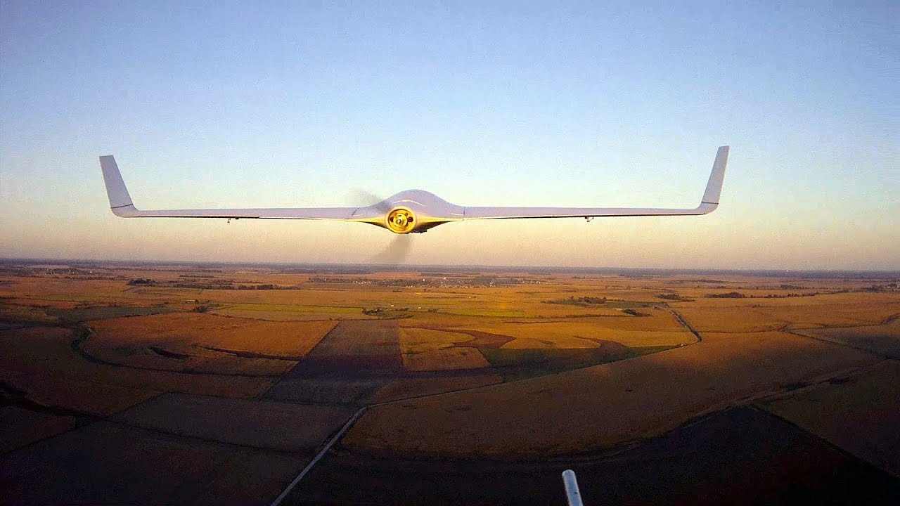
Medium Fixed:FireFLY6 PRO hybrid-fixed wing VTOL aircraft with FLIR Vuo PRO ($11,500 when purchased together from BirdsEyeView)
Combining the versatility of a multi-rotor option and the performance of a fixed wing aircraft is the next suggestion, he FireFLY6 PRO. This aircraft uses advanced flight control systems allowing it to takeoff and land vertically and then, once at altitude, low cost fixed wing option.
This aircraft should provide versatility in take off and landing similar to that of the multirotor option, but more care must be practiced in how this aircraft is oriented during landing if not being performed autonomously. Once operational the aircraft can cover more ground without changing batteries than multirotor options and land in smaller area than other fixed wing options. The aircraft has onboard lighting allowing for identification and orientation during night operations. This is a solid option for the large scale, minimal obstacle flights that would be required to track turtle populations.
The FLIR Vuo PRO sensor is our suggested package as it is a full thermal sensor capable of operation at night. This sensor will allow thermal gradient contrast and logged heat values for turtles allowing for very easy identification. The sensor could potentially work during the day because of the logging feature because, while turtles are cold blooded and could in theory match the temperature of their environment, there is likely to be some temperature difference as they are leaving cooler water for the hot beach and their bodies interact with solar radiation differently than sand. This sensor is the most capable so far on this list for monitoring wildlife.
 Image by BirdsEyeView
High Cost Drone Options
High Multi: The Vanguard (aprox. $45,000)
Lastly, as the higher end option, The Vanguard by Airbornedrones is suggested. Typically labelled as a long range surveillance drone, this UAV has everything necessary for the survey mission. This drone is built for monitoring wildlife as a main function without any add ons. One of the top features of this UAV is that there is a low noise footprint.
Here are some of the specs for The Vanguard from airbournedrones.co. This UAV has a flight time of 94 which is the 2nd highest on this list of options. The aircraft has a 35 km range and can fly 18 meters per second. The aircraft can withstand winds up to 37 km/h. It comes with its own Skylink software system. The platform comes with JAR gimbal duel sensors (10xs optical and thermal). The sensors are water resistant, and they are perfect for high quality target tracking especially at night to record any reproduction tracking.
This platform had the most details and fits more requirements than any of the multirotors on this list. Some unique scecs of this platform is that its frame is water resistant. The aircraft features a virtual fence where you can control where to put safe zones. All in all, The Vanguard will be efficient at getting the mission performed.
High Fixed: Penguin B or BE (aprox. $50,000) with UAV factory epsilon 135 night (Aprox $20,000): Total aprox $70,000
This option is very difficult to accurately price because the aircraft is highly customizable. Generally speaking, both aircraft option (Penguin B or Penguin BE) will likely cost about $50,000. This aircraft, while large is highly versatile. Due to sound considerations we are mostly going to discuss the Penguin BE, the electric propulsion version, as it is significantly quieter than the gas engine version, Penguin B. The only significant performance difference is flight time, so if the flight time of the BE aircraft is insufficient, we recommend considering the Penguin B.
The Penguin BE while more cumbersome to bring to a field site due to relatively large size, can be launched in a variety of ways making it an ideal candidate for the Hawaiian coastline. The aircraft can be launched via catapult, car mounting, or standard ground run takeoff. If the standard takeoff option is selected, the aircraft only needs 90 feet of “runway”. The aircraft is also waterproofed from rain, an important consideration on some parts of the Hawaiian island chain. The aircraft boasts the best flight time of all our options at 110 minutes at a high cruise speed of 22 m/s, allowing for a very large area to be covered adequately. Arrested, standard, and even car capture landings are possible with this system. As far as flight performance it is very capable.
The sensor we recommend is the epsilon 135 night IR sensor package. This sensor is made by the same developer of the Penguin series aircraft, UAV factory, and is designed to be utilized with the Penguin aircraft. The sensor is gimbaled so that a sensor operator can utilize the sensor multi directionally while another crew member flies. However, with the piccolo autopilot features, the aircraft is famously possible to fly with one crew member that also utilizes the sensor gimbal. The sensor also actively tracks any target and processes all imagery onboard. Sea turtles could be actively tracked, hands free, so that a population inventory can be conducted extremely efficiently. The 640 x 480 infrared sensor with 60mm lense allows for high resolution tracking of turtles so that its species can be easily delineated when paired with the automatic video stabilization. The epsilon 135 when paired with the Penguin B can be an extremely efficient wildlife surveillance system.
Image by Pinterest User Elite Daily